Locating Earthquakes using Geiger’s Method (codes included)
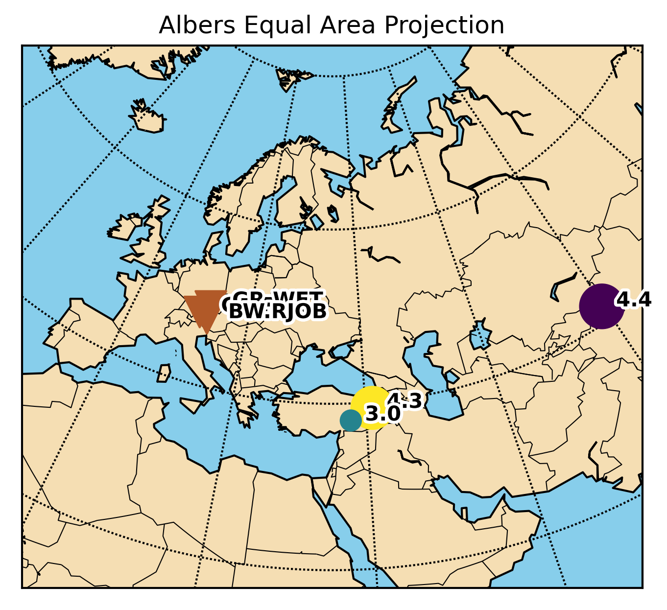
Simple earthquake location problem and its solution using Geiger’s method

Earth Inversion
Technical writing on geophysical pipelines, scalable data analysis, and reproducible research engineering.
Peer-reviewed work in seismology, structural health monitoring, and large-scale inversion.
End-to-end workflows for high-volume scientific data: ingestion, QC, feature extraction, and modeling.
Cloud and web platforms for real-time sensing, visualization, and operational analytics.
Simple earthquake location problem and its solution using Geiger’s method
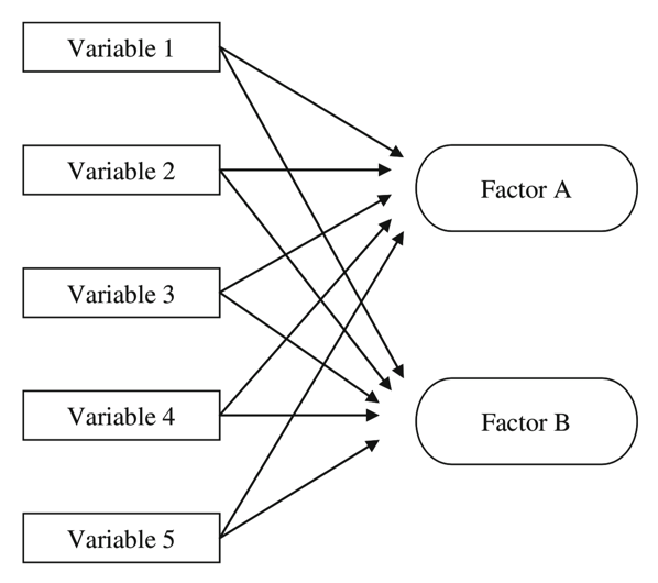
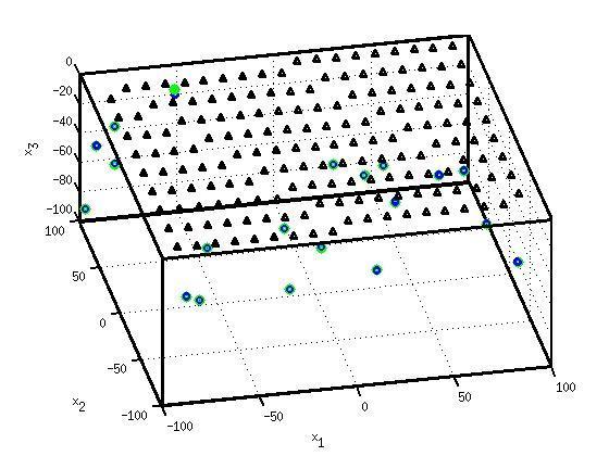
Factor Analysis is an exploratory data analysis method used to search influential underlying factors or lat...
Recent technical articles on seismic analytics, scientific computing, numerical modeling, and production data workflows.
This post is aimed to resolve the issues regarding the conflicts of using obspy and basemap libraries together.
Time-series analysis is essential in most fields of science, including geophysics, economics, etc. Most of the geophysical data comes in a time-series format...
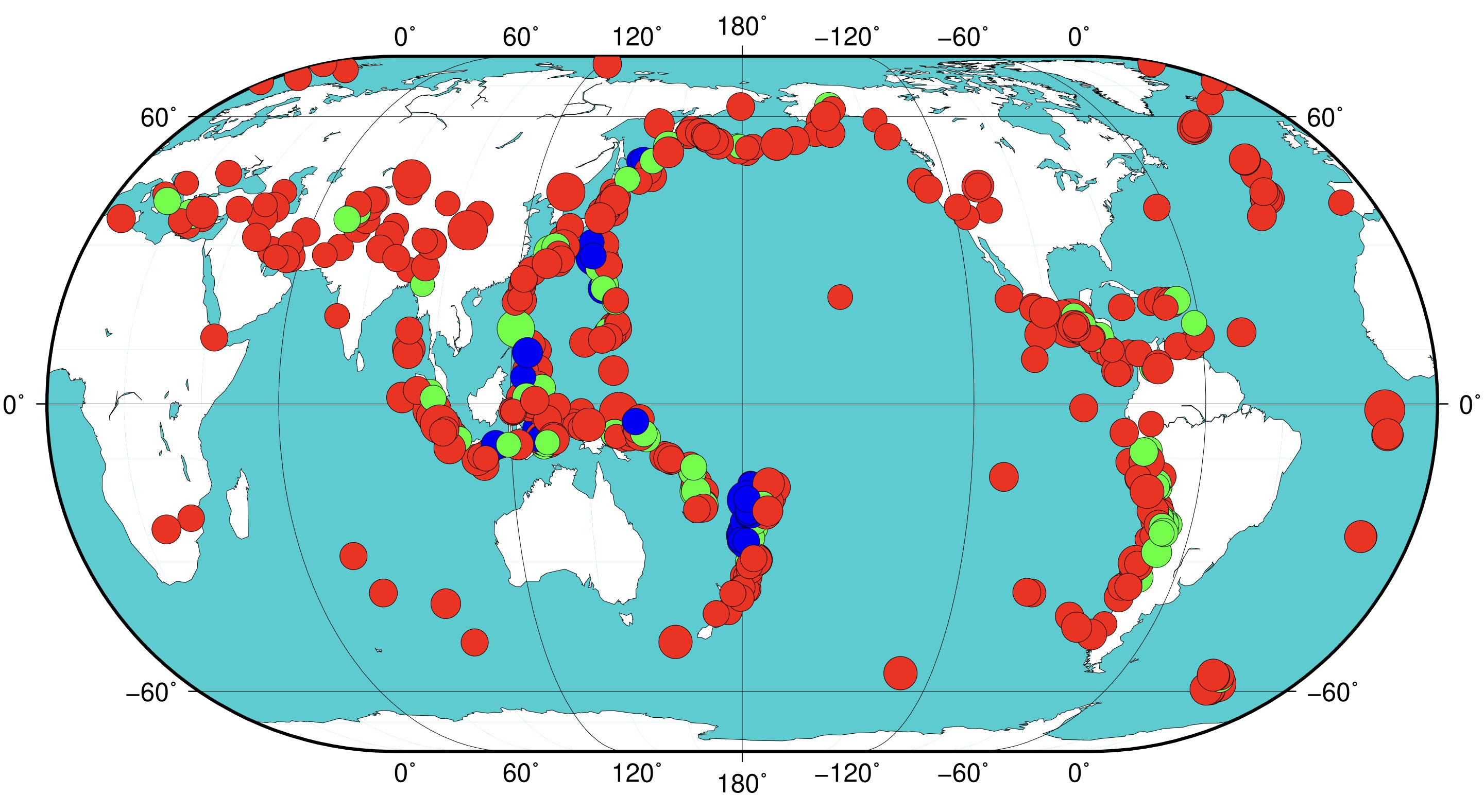
The Generic Mapping Tools is widely used across Earth and Planetary and other fields of studies to process data and generate high-quality illustrations. This...
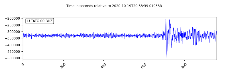
Obspy is an open-source Python framework developed for the processing of seismological data. In this post, I will introduce how to use Obspy along with some ...
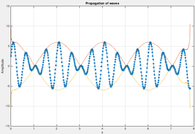
We demonstrate how to model a simple wave, obtain its frequencies, apply Hilbert transform, and perform edge detection
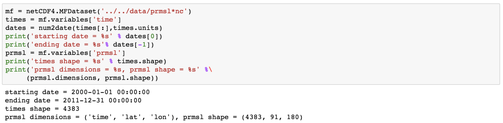
NetCDF file format has been designed for storing multidimensional scientific data such as temperature, rainfall, humidity, etc. In this post, we will see how...
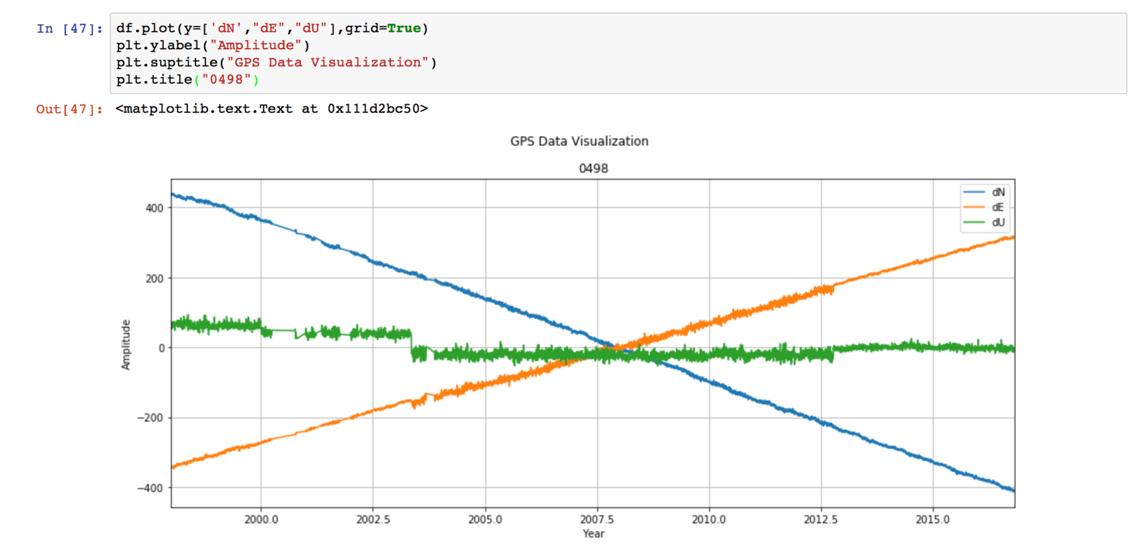
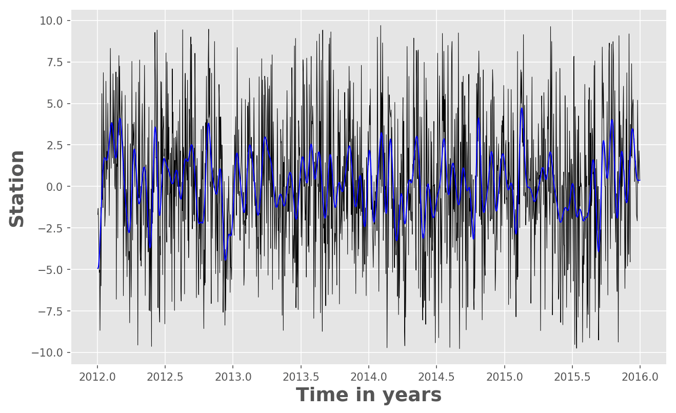
In this post, we will see how we can use Python to low-pass filter the 10 year long daily fluctuations of GPS time series. We need to use the “Scipy” package...
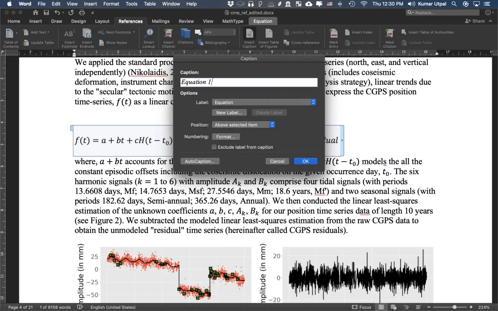
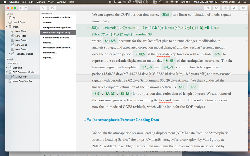
It is essential to insert equation numbers in your thesis and/or any scientific paper. In this post, I will show you some of the easiest ways to insert equat...
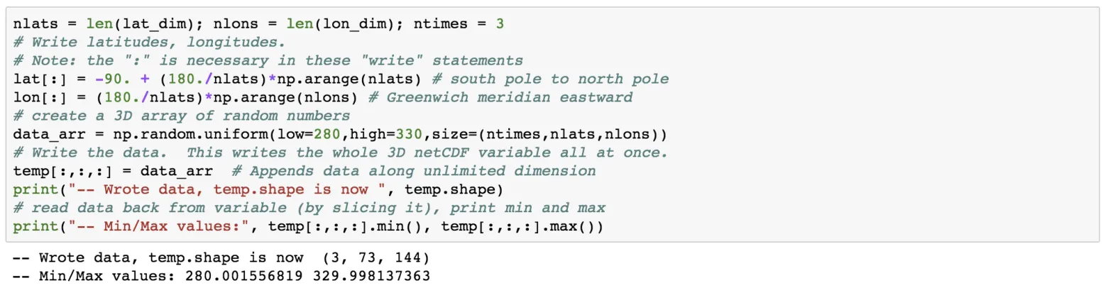
In Earth Sciences, we often deal with multidimensional data structures such as climate data, GPS data. It ‘s hard to save such data in text files as it would...
Ulysses is a natural, freestyle way of writing. If you got any idea, just write it down, worry about the format and other things when you’re done. Don’t let ...
A simple tutorial on how to plot high resolution topographic map using GMT tools in Python
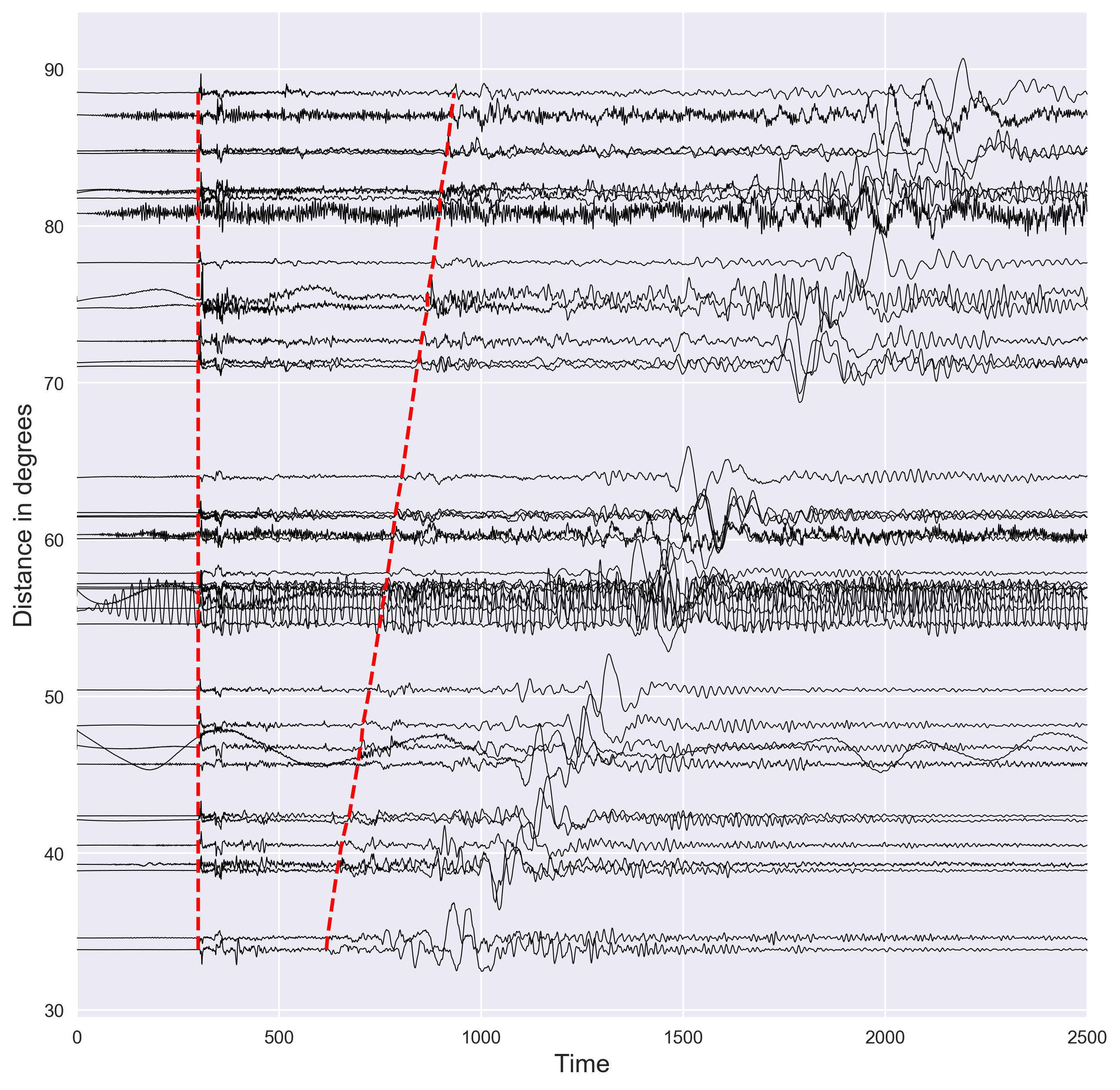
Short demostration of how to plot the distance vs seismic waveforms and mark the P and S arrival times using the IASP91 earth model. Codes are included.
This post is aimed to resolve the issues regarding the conflicts of using obspy and basemap libraries together.
Time-series analysis is essential in most fields of science, including geophysics, economics, etc. Most of the geophysical data comes in a time-series format...
The Generic Mapping Tools is widely used across Earth and Planetary and other fields of studies to process data and generate high-quality illustrations. This...
Obspy is an open-source Python framework developed for the processing of seismological data. In this post, I will introduce how to use Obspy along with some ...
We demonstrate how to model a simple wave, obtain its frequencies, apply Hilbert transform, and perform edge detection
NetCDF file format has been designed for storing multidimensional scientific data such as temperature, rainfall, humidity, etc. In this post, we will see how...
In this post, we will see how we can use Python to low-pass filter the 10 year long daily fluctuations of GPS time series. We need to use the “Scipy” package...
It is essential to insert equation numbers in your thesis and/or any scientific paper. In this post, I will show you some of the easiest ways to insert equat...
In Earth Sciences, we often deal with multidimensional data structures such as climate data, GPS data. It ‘s hard to save such data in text files as it would...
Ulysses is a natural, freestyle way of writing. If you got any idea, just write it down, worry about the format and other things when you’re done. Don’t let ...
A simple tutorial on how to plot high resolution topographic map using GMT tools in Python
Short demostration of how to plot the distance vs seismic waveforms and mark the P and S arrival times using the IASP91 earth model. Codes are included.